Epic rains and snow help the ‘inland sea’ of Sacramento roar back to life

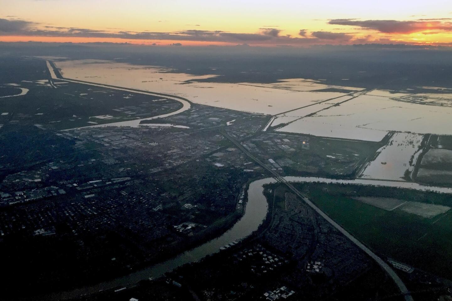
The Yolo Bypass is one of California’s most daring and critical pieces of water infrastructure. The bypass is now filled like it hasn’t been in the last five years of drought.
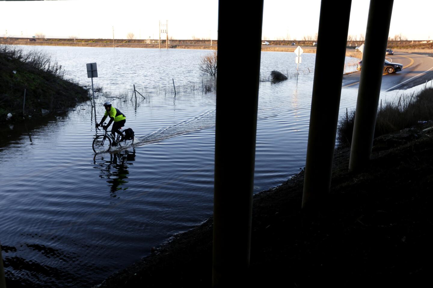
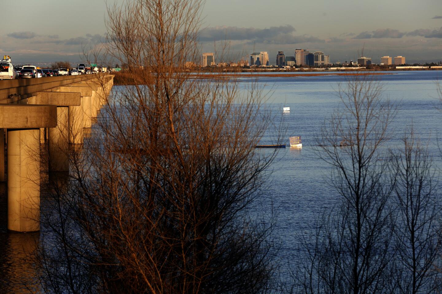
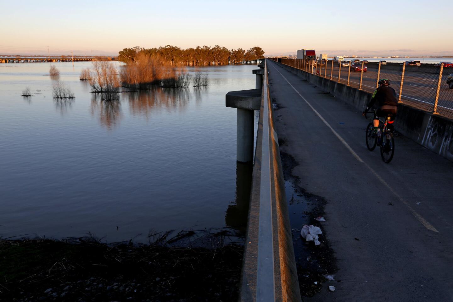
Most of the time, motorists driving on Interstate 80 between Davis and here look out on vast tracts of farms and wetlands.
But over the last two weeks, something remarkable has happened in what is known as the Yolo Bypass. Runoff from epic rains and snow has filled the open space with water.
Now, drivers on the freeway pass over miles of water on their trek, making the interstate appear like long bridge over a wide lake.
And that’s exactly how engineers envisioned it when they built it about a century ago.
The Yolo Bypass is one of California’s most daring and critical pieces of water infrastructure, collecting runoff from various streams and rivers from the Sierra Nevada and other mountain ranges to prevent Sacramento and surrounding suburbs from being flooded.
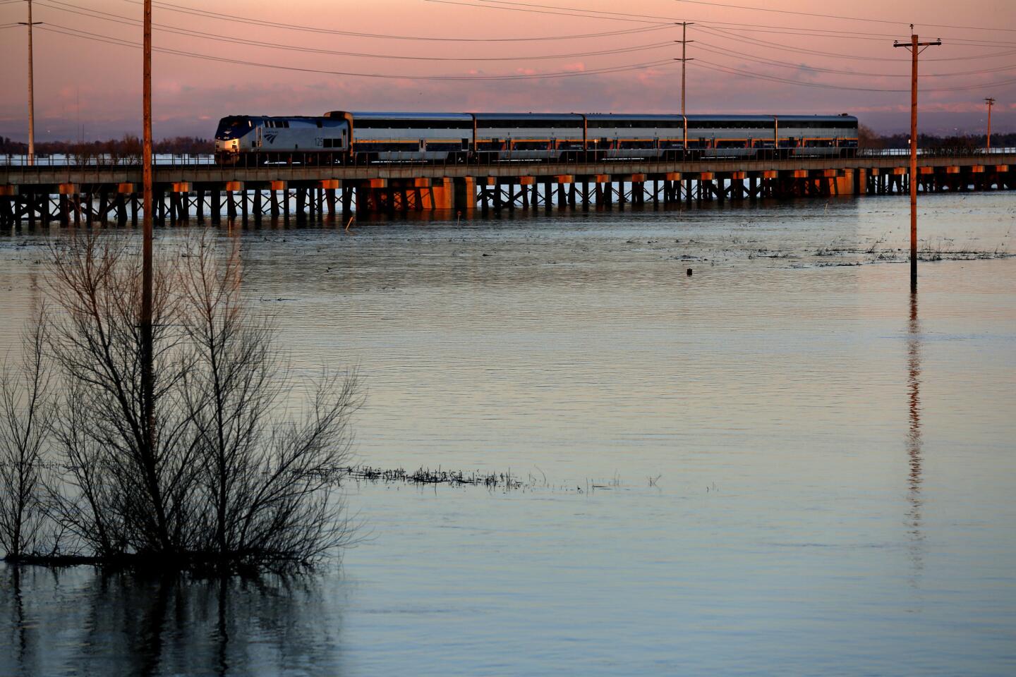
The bypass is now filled like it hasn’t been in the last five years of drought, with officials estimating that a whopping 1 million acre-feet have passed through in the last few weeks. That amount of water could fill nearby Folsom Lake to the brim.
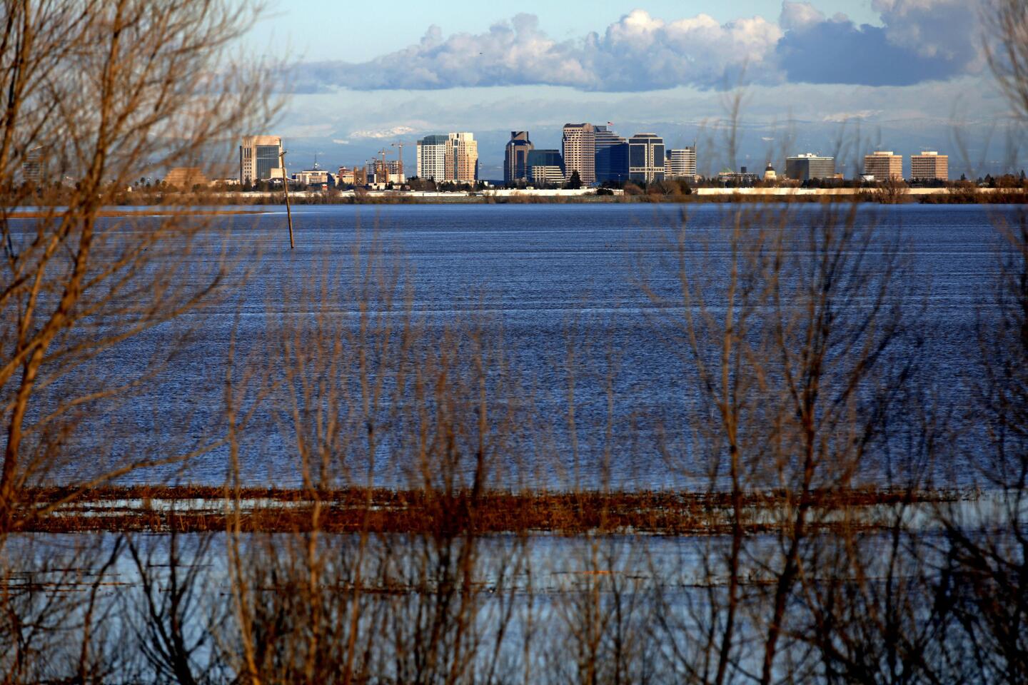
“It’s an inland sea,” said Jay Lund, director of the Center for Watershed Sciences at UC Davis.
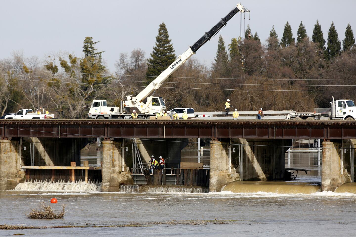
So much water came rushing down from the state’s rivers this month that for the first time since Dec. 31, 2005, state workers opened up the floodgates of the Sacramento Weir — a low spot in the levees that can allow river waters to pour into this historic floodplain.
The area is well-known to anyone who has driven from San Francisco to Sacramento and lies underneath Interstate 80 as the freeway approaches California’s capital. The causeway is elevated so that the land below it — fields used in the summer for rice, sugar beets, corn and tomatoes — can become a flowing lake that spares Sacramento from the threat of floodwaters.
At its greatest capacity, the Yolo Bypass can handle five times as much water as can the narrow banks of the Sacramento River. And it has performed spectacularly.
“This whole city of Sacramento could not exist as it does without that bypass,” said Nancy Vogel, spokeswoman for the California Natural Resources Agency.
A completely full Yolo Bypass provides enough water to double the wetted area of the Sacramento-San Joaquin River Delta, the joining of the two longest rivers in California. That’s equivalent to one-third the area of the San Francisco and San Pablo bays.
The full bypass is a testament to how much water has poured out of the sky this month. The central Sierra Nevada has had its wettest January in recorded history. With a few more days to go this month, it is already the fourth-wettest January in Sacramento, which has seen nearly 10 inches of rain, more than triple the average. Mammoth Mountain has had a record amount of snow in January — 20½ feet so far.
All those storms have brightened the drought outlook. A year ago, more than 95% of California was in some form of drought; now, 51% of the state remains in moderate to extreme drought, according to the U.S. Drought Monitor.
RELATED: How a ‘rain shadow’ left this reservoir parched even after all those storms »
That precipitation has caused dramatic amounts of water to flow down the state’s major rivers. And the only way to contain them from flooding California’s capital is the wide Yolo Bypass.
Flooding in the Central Valley is part of California’s natural history. In fact, California’s two great valleys, the Sacramento and San Joaquin, were once underwater.
“It was a much larger version of San Francisco Bay,” said Mitchel Russo, chief of river forecasting for the California Department of Water Resources. “The only reason we’re standing on it is because we are standing on thousands of centuries of sediment that’s been brought down from the Sierras.”
In his book “Battling the Inland Sea: Floods, Public Policy, and the Sacramento Valley,” historian Robert Kelley describes 19th century winter rains annually creating a 100-mile-long inland sea, blanketing the center line of the Sacramento Valley, which only slowly drained into river channels and through the delta before waters coursed out of San Francisco Bay.
Everything changed after the discovery of gold by Swiss adventurer John Sutter’s foreman along the upper reaches of the American River. Suddenly, thousands of people poured into the new city of Sacramento, built where the American and Sacramento rivers met.
Almost immediately, Sacramento’s disastrous relationship with flooding began. The flood of 1850 dramatically showed how Sacramento was built in the middle of the annual inland sea. The legendary flood of 1862 was said to have forced the state’s eighth elected governor, Leland Stanford, to row through floodwaters to his inauguration and then back home to climb in through the second story. In Sacramento, old homes’ entrances are on the second floor, as “the first story was essentially sacrificial,” Lund said.
For years, California tried to deal with the flooding by relying only on levees on either side of the river. But “if you just had levees everywhere, the river would eventually break the levee in an uncontrolled fashion,” said John Cain, an expert with the conservation group American Rivers.
Another idea, promoted by Colusa Sun newspaper editor William Green in the 1860s, suggested a more natural approach: create a designated floodplain that would allow the Sacramento River to flood as it had done in centuries past.
“His idea was to allow the river to do what it was going to do, which was to spill its banks,” Russo said. “It’s going to do that once in a while. You just gotta accept it.”
After devastating floods in 1907 and 1909, steps were taken to build the Yolo Bypass, as well as another one further upstream, the Sutter Bypass.
The bypass system is essential because of the massive precipitation that can fall in California when so-called atmospheric river storms — long plumes of water vapor — pour over from the Pacific Ocean and hit the Sierra Nevada, as they did this month.
“The Sierra tends to wring that moisture — it kind of squeezes it like a wet sponge … and drops it on the western slopes of the Sierra,” Russo said.
“What we get is a very large amount of water for the size of the watershed,” he added.
By the 1930s, much of the Sacramento Flood Control Project, including the Yolo Bypass, was in place.
There are two main entrances to the 40-mile-long Yolo Bypass. To its north, water coming from the Sacramento River, the Feather River and the Sutter Bypass enters through the Fremont Weir, completed in 1924, essentially a six-foot-tall curb that usually keeps water flowing in the Sacramento River during normal flows, but naturally allows floodwaters to spill into the bypass when water levels rise.
To its east is the Sacramento Weir, finished in 1916. Floodgates here must be manually opened by workers, and this entry primarily allows water to flow in from the American River. Workers opened the gates on Jan. 10 and completed closing them on Thursday. “It will take some days or weeks to drain,” Lund said.
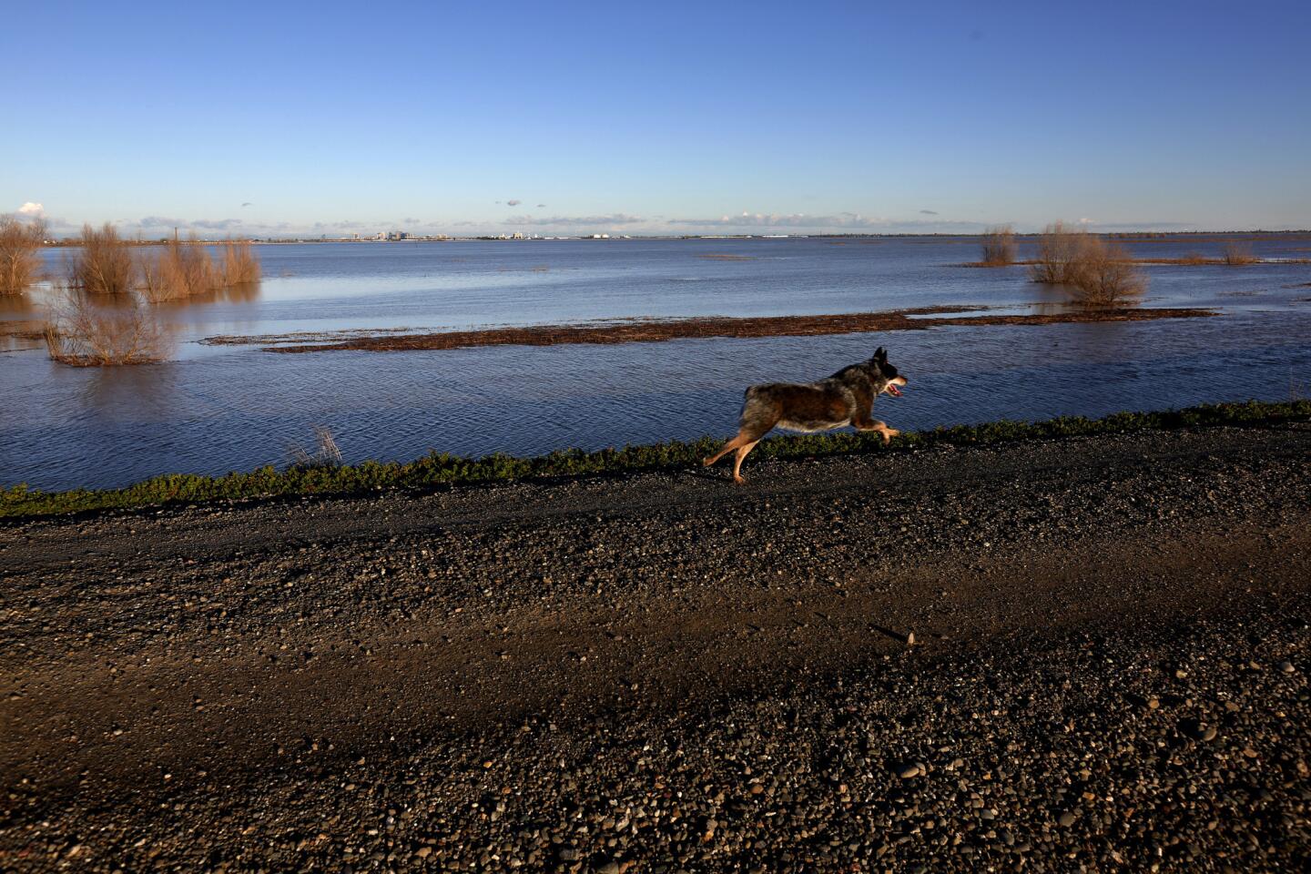
Other creeks drain naturally into the Yolo Bypass, which in addition to being used as farmland is also set aside as a wildlife area, shared by birdwatchers, schoolchildren and hunters. The bypass is in the heart of the Pacific Flyway and is home to waterfowl and migratory birds.
Another river has also used the concept of the bypass system — the Mississippi. The river’s massive floods of 2011 caused officials to open up the Morganza Floodway to divert water from Baton Rouge and New Orleans to the Atchafalaya Basin in Louisiana, the first time that had been done since 1973. Waters flooded trees, swamps and fields of wheat, soybean and sugar cane.
There are discussions underway to expand the Yolo Bypass. Among the ideas are to expand the weirs, allowing more water to flow in, and to move levees surrounding the bypass further inland, increasing capacity of the floodplain.
There are also ecological benefits to the floodplain, Cain said. Juvenile salmon there have access to much more food and are farther away from predators who don’t get onto the floodplain.
Cain said expanding and carving out new floodplains along the Sacramento and San Joaquin rivers will be important in the coming years to protect California from disastrous flooding that breaks levees. One plan is to create a new flood bypass near Stockton, Cain said, which will require the purchase of easements, or permission to flood land, from farmers during the rainy season.
In the decades to come, rising global temperatures are expected to cause storms to dump more warmer rain instead of colder snow on California, which will worsen floods when they happen.
The U.S. Geological Survey has warned that a repeat of the great 1862 flood would overwhelm California’s flood protection system and cause floodwaters in the Central Valley 300 miles long and over 20 miles wide.
Times staff writers Matt Stevens and Joseph Serna contributed to this report.
Twitter: @ronlin
ALSO
257 drought maps show just how thirsty California has become
In flooded Seal Beach, residents accuse the city of not being prepared
In a major improvement, nearly half of California is no longer in a drought


Start your day right
Sign up for Essential California for news, features and recommendations from the L.A. Times and beyond in your inbox six days a week.
You may occasionally receive promotional content from the Los Angeles Times.


