Road trip from the Southland: Las Vegas, Utah and Arizona


In Southern California, road trips are like onions. They’re good year round. Well, as long as you don’t venture too far.
In January, I drove more than 1,200 miles, from the Los Angeles area to Las Vegas and then to southern Utah and Arizona to visit Zion, Bryce Canyon, Lower Antelope Canyon and Horseshoe Bend.
I had been to three of the four, but in summer and spring, when I had plenty of company on the road. In the winter, I didn’t have to share.
Whether you go during the warmer months or in the winter, here’s some advice I’ve gathered from recent trips.
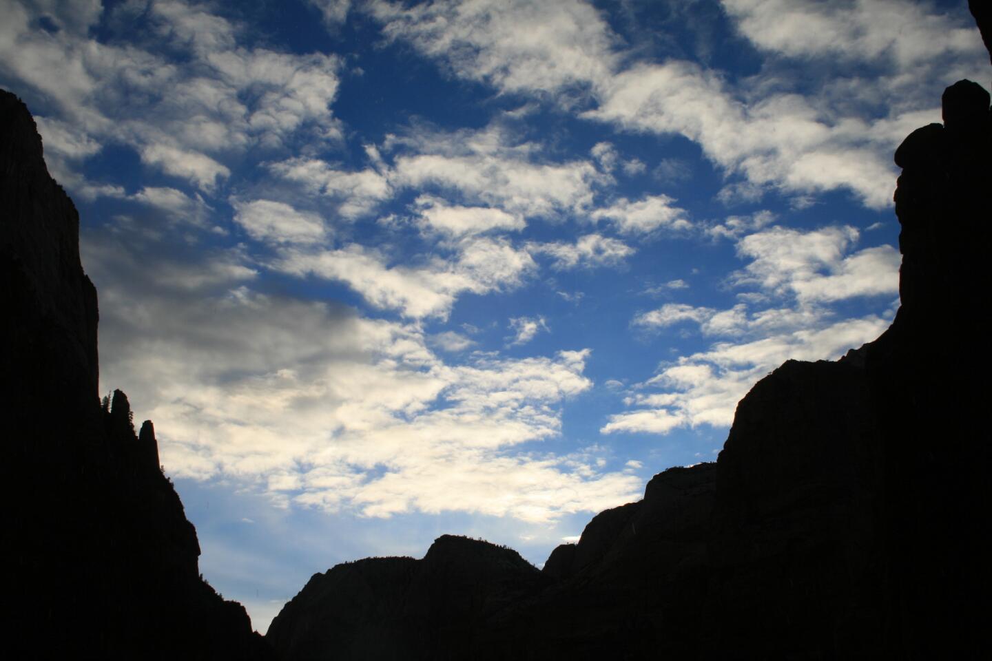
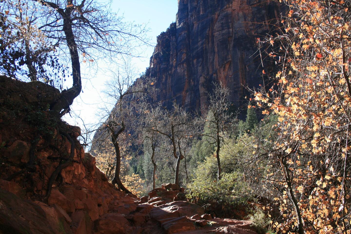
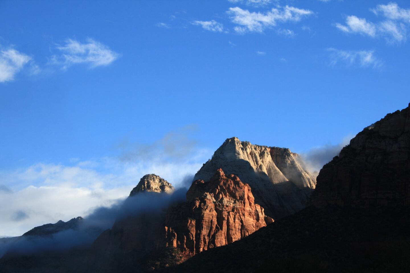
Zion, once called Mukuntuweap National Monument, encompasses 229 square miles in southwestern Utah. The scenery is first-rate, from sweeping views of Zion Canyon to close-ups of sandstone rock formations.
It offers a range of hikes, including ones you can take your grandma on, and scary ones that will make your palms sweaty. In the summer, park shuttles whisk visitors from one trailhead to another. The shuttles don’t run in the winter, but the roads are open to private vehicles.
By the way, if you lost a ring along the road near Zion Lodge, tell me what’s engraved on the inside and I’ll send it to you.
Hikes
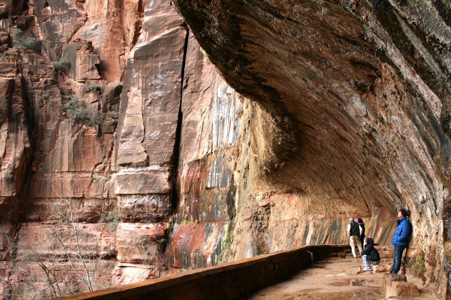
Weeping Rock Trail — This half-hour hike (round trip) takes you beneath Weeping Rock, a huge sandstone rock formation from which water drips like a gentle rain.
Canyon Overlook Trail — This is an excellent hour-long hike. You’ll get stunning canyon views and pass jagged rock formations. If you’re lucky, you’ll see some goats. The hike gets steep in some places, but the guard rails will help you keep your balance.
Observation Point via East Rim Trail — A great hike, but not if you’re afraid of heights. The steep drops made my fingers tingle, but I’ve seen young children on this hike, so I guess it’s not that scary.
The Narrows via Riverside Walk — I didn’t care to do this hike in 40-degree weather, but it’s great during the hot summer months. The hike takes you into the river, which can get fairly deep as you descend into the Narrows. Make sure to take the right shoes if you do plan to do this hike. I recommend strap-on Teva sandals.
Upper and Lower Emerald Pool trails — The lower trail, which passes beneath a waterfall, is quite nice. Compared with the park’s other hikes, the upper trail is nothing special.
More hikes: https://www.nps.gov/zion/planyourvisit/
Lodging
Cable Mountain Lodge — I’ve stayed at the lodge during each of my two overnight trips to Zion. The lodge lies at the foot of the park, and the rooms are spacious and comfortable. Suites come with a fully equipped kitchen, convenient in the winter when many of Springdale’s restaurants are closed. 147 Zion Park Blvd., Springdale, Utah.
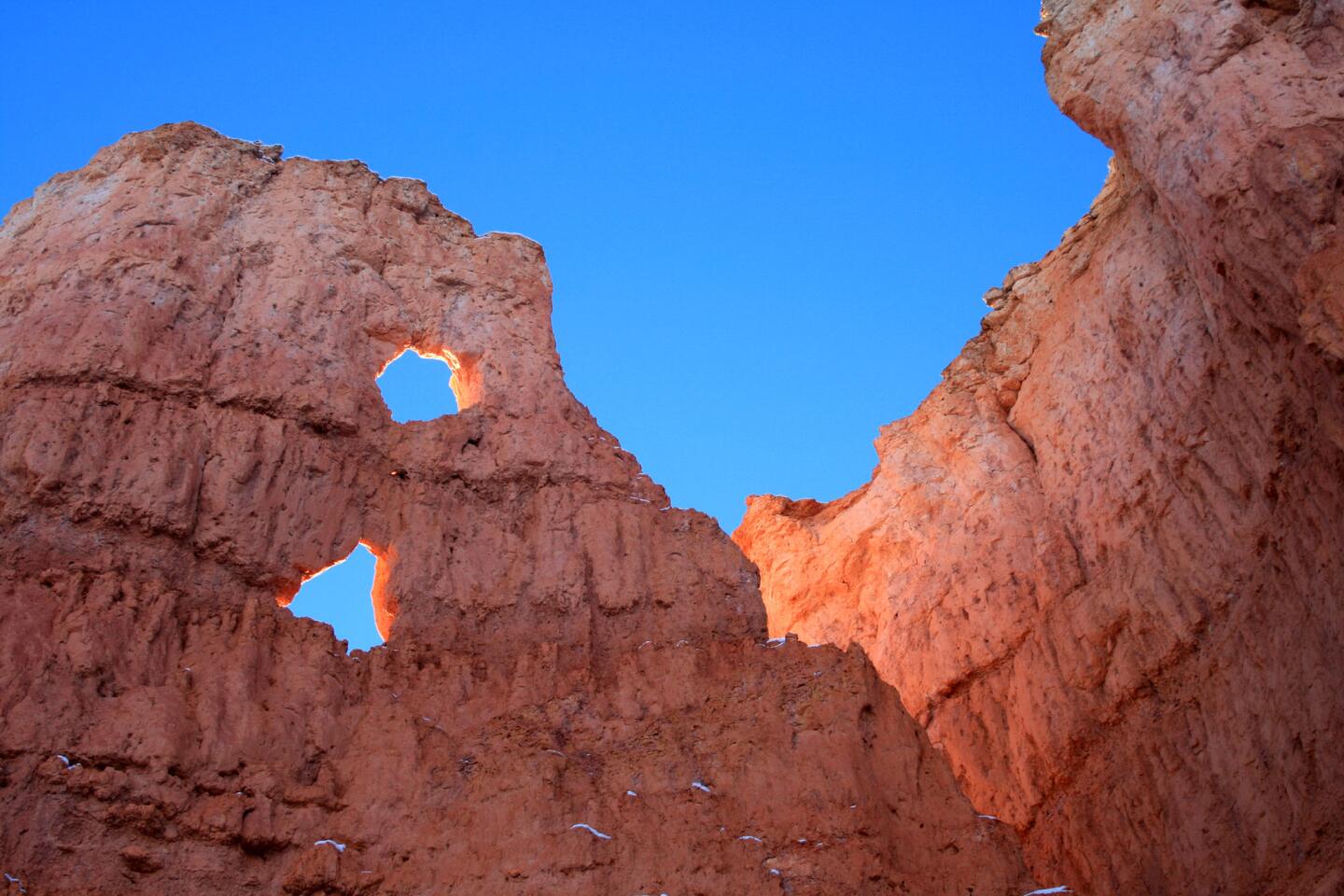
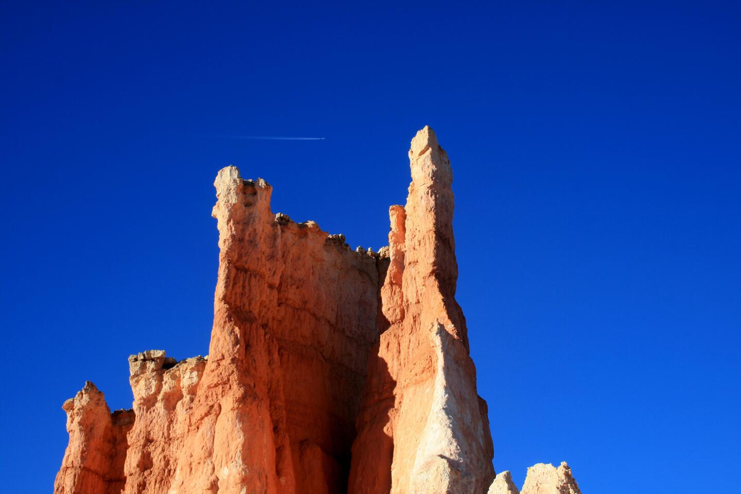
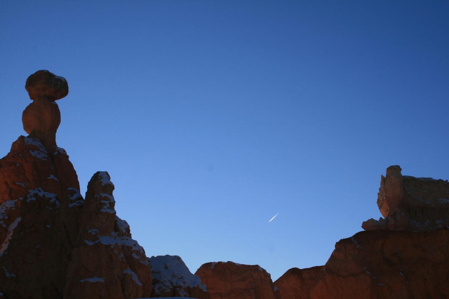
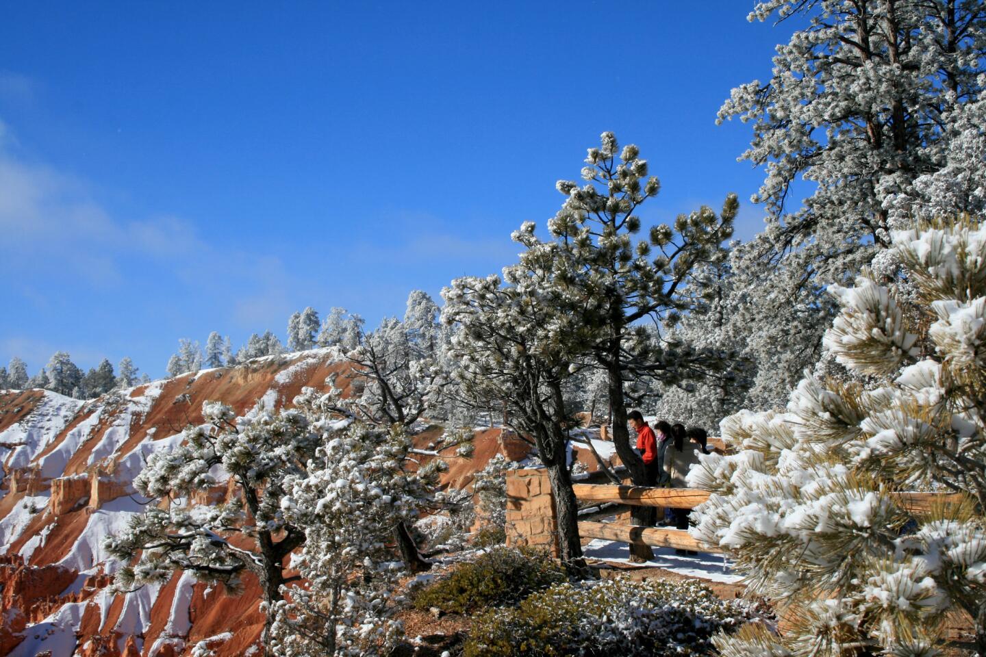
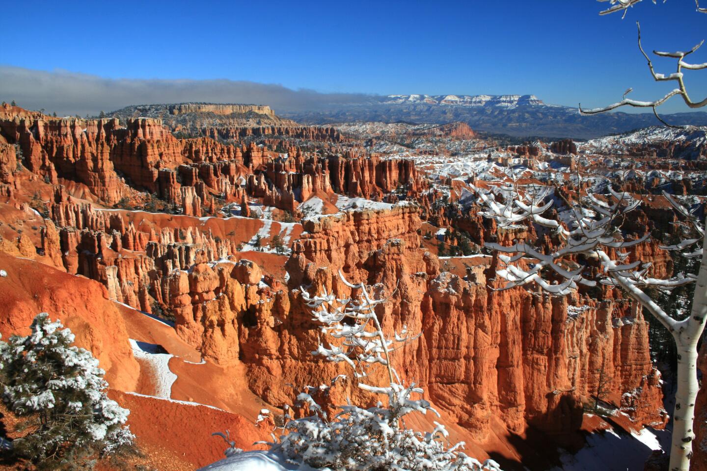
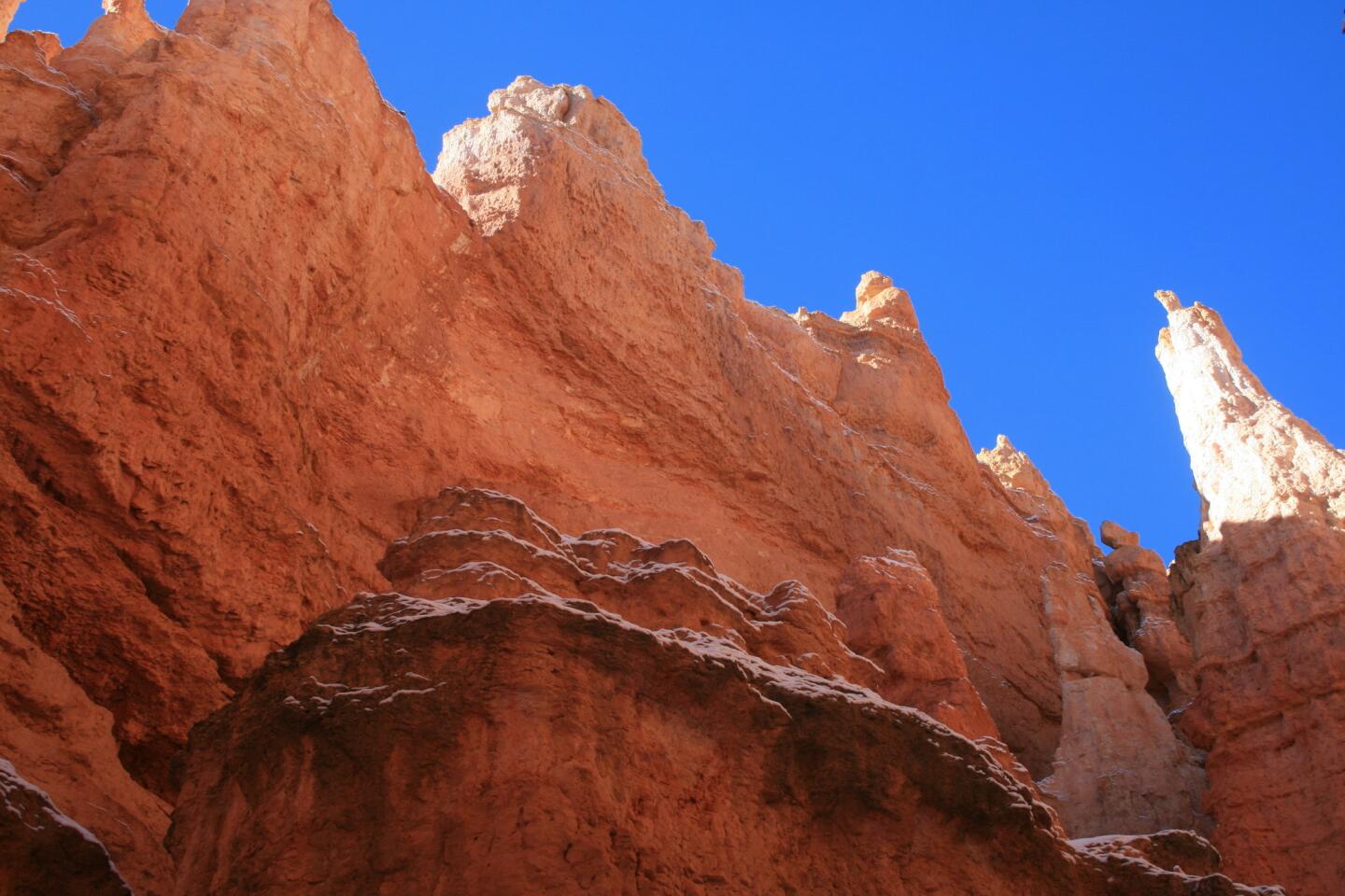
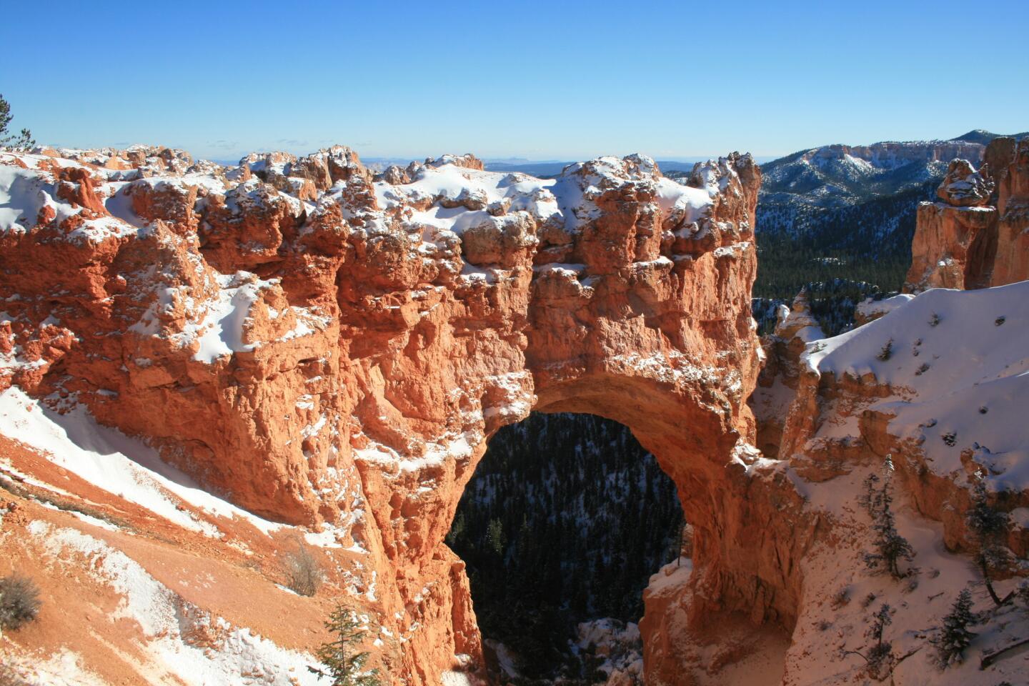
Bryce, named after Mormon Pioneer Ebenezer Bryce and established as a national park in 1928, occupies about 56 square miles of land in south-central Utah.
Its multicolored rock formations, including huge arches, spires, slots canyons and windows attract about 1.3-million visitors each year.
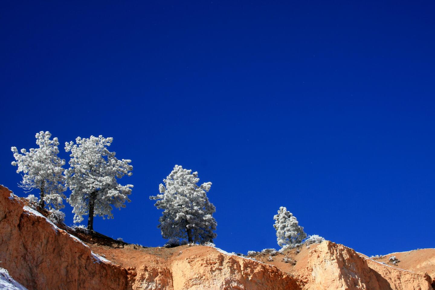
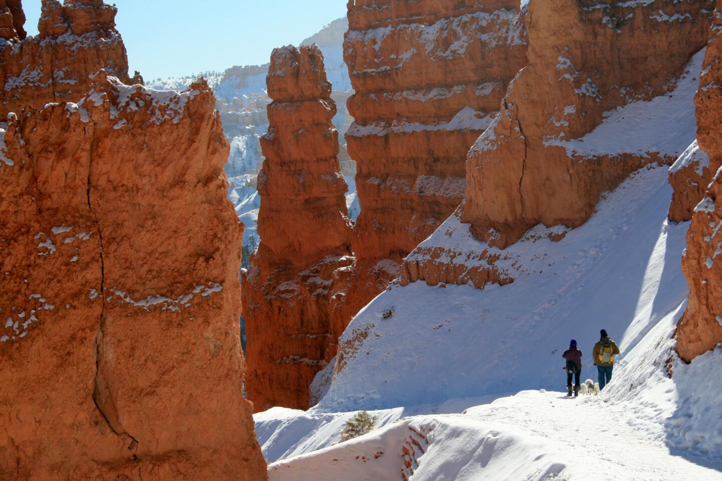
If you don’t mind the cold, visit Bryce Canyon in the winter. Snow enhances the fairytale-like quality of its hoodoos. As you might imagine, however, snow and ice make hiking more challenging, especially hikes into Bryce’s amphitheaters.
Hikes
Queens Garden — This scenic 1.8-mile trail takes you into Bryce Amphitheater and passes through numerous rock formations, including one shaped like Britain’s Queen Victoria near the terminus of the trail.
Navajo Trail — The trail, a 1.3-mile loop, is short but steep and descends into Bryce Amphitheater. In the winter, the last part of the loop is closed, so be prepared to backtrack your way out or extend your hike to another trail.
More hikes: https://www.nps.gov/brca/planyourvisit/hiking.htm
Sights
Sunrise Point — The Point affords great views of Bryce Amphitheater. On clear days, you can see for miles. Formations visible from here include Boat Mesa and Sinking Ship.
Sunset Point — Aside from taking in the sunset, this point is a great spot for birdwatching. Check out Thor’s Hammer when you’re here.
Natural Bridge — This isn’t really a bridge but a humongous arch carved by erosion.
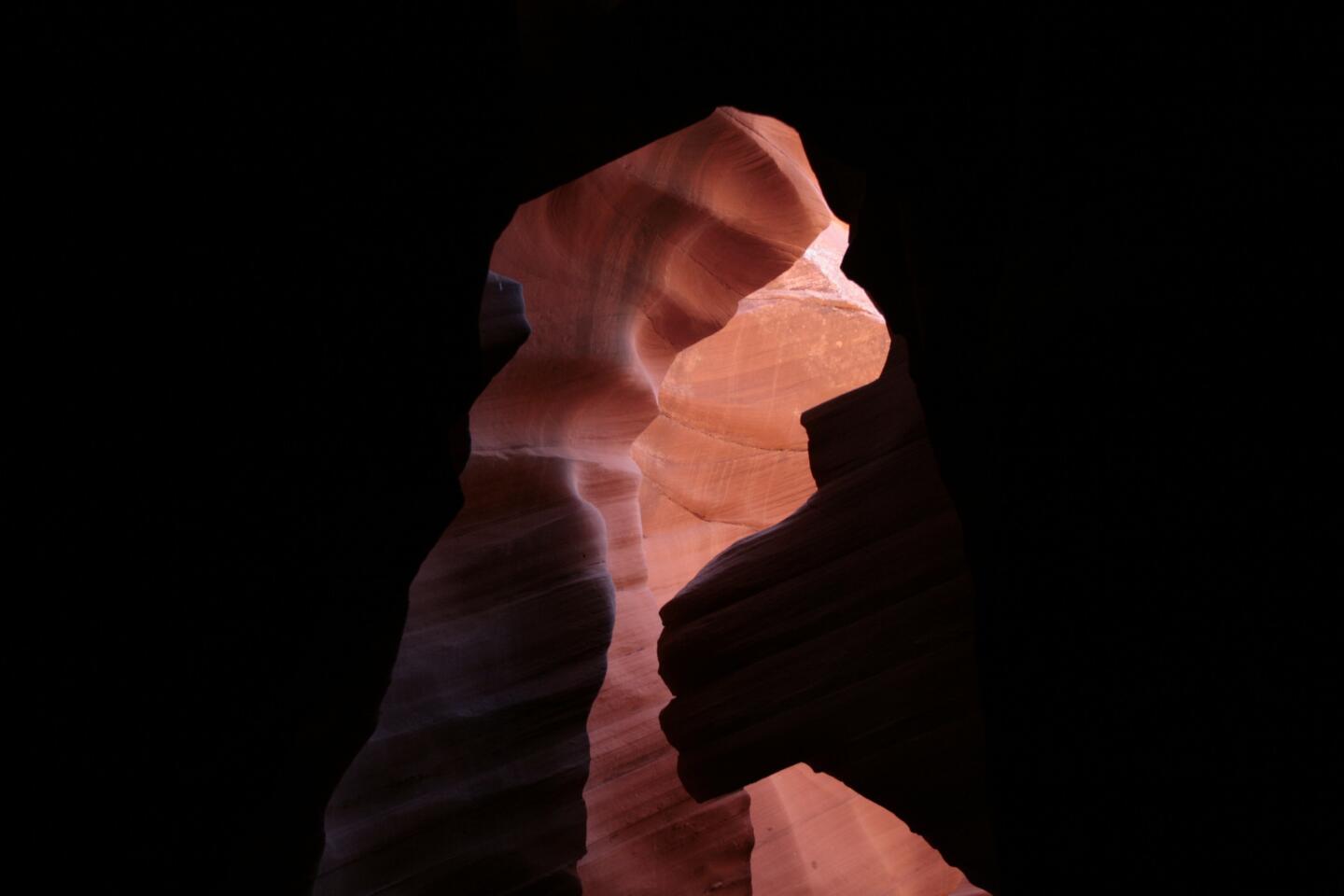
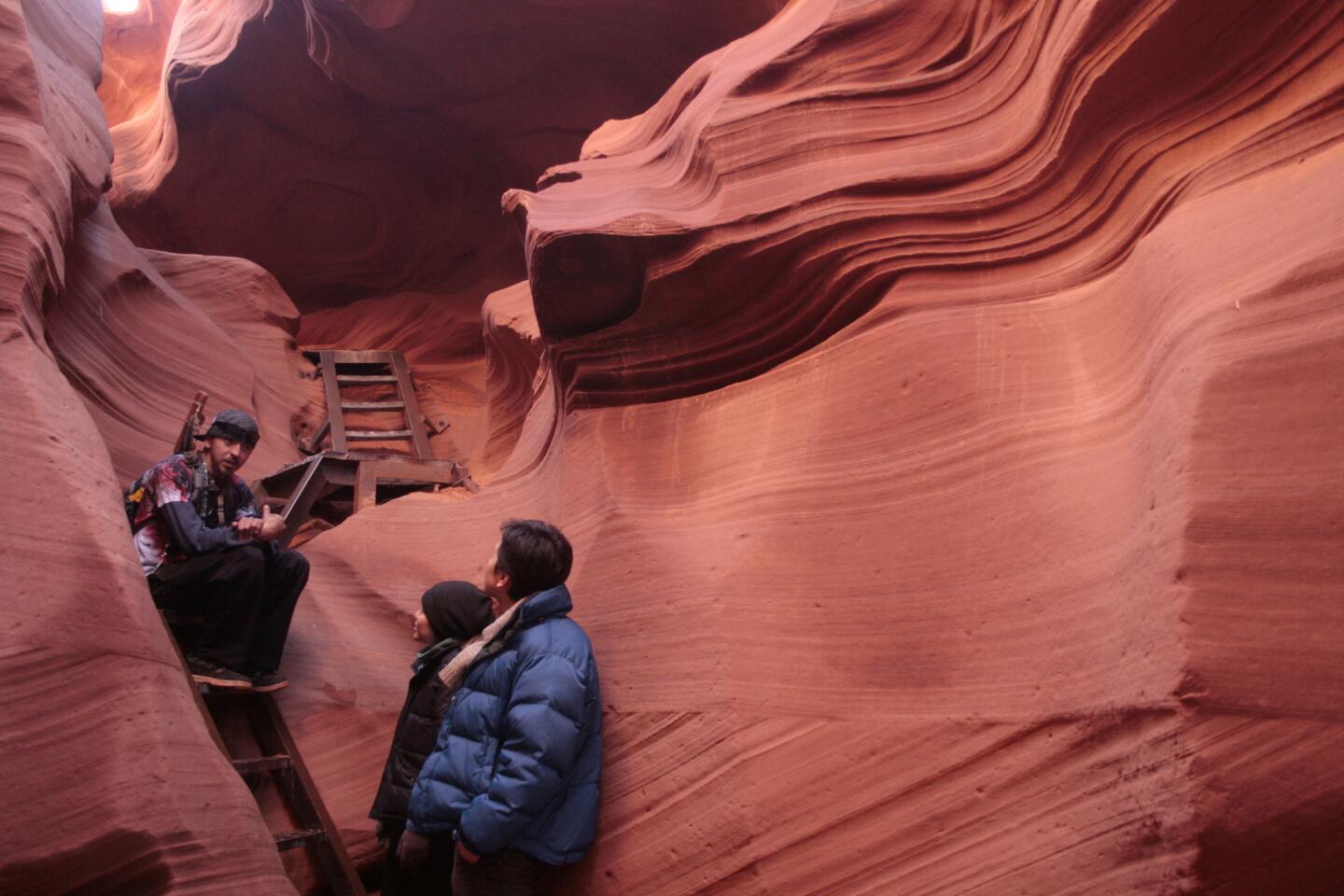
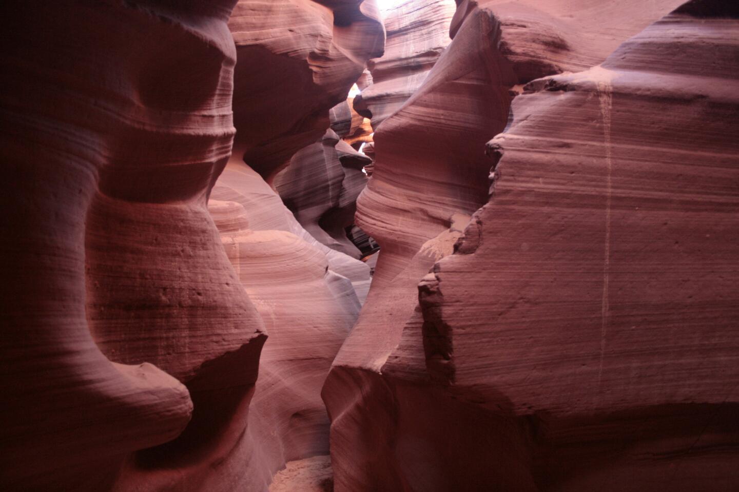
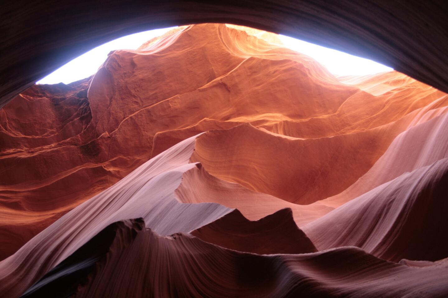
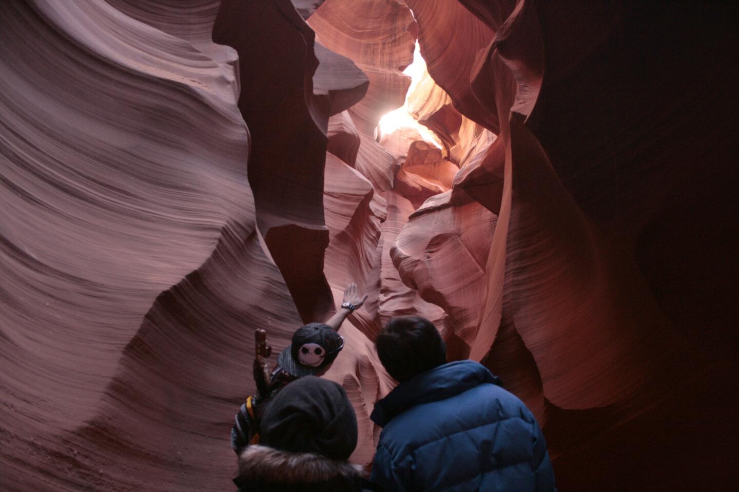
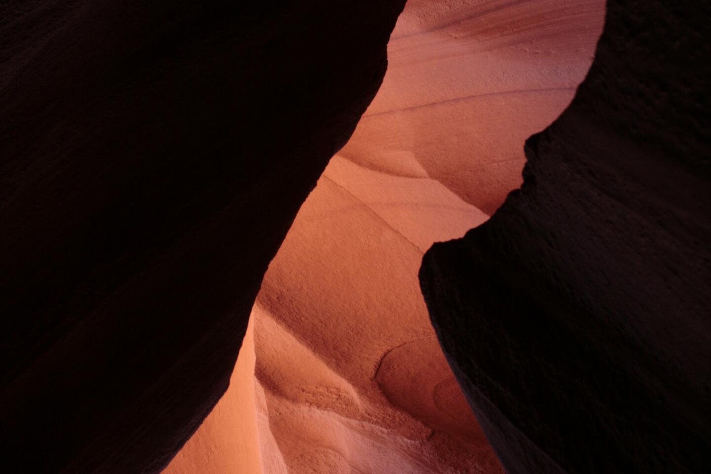
If you’ve ever perused a gift shop postcard rack, you’ve probably seen pictures of Lower Antelope Canyon. The slot canyon, on the southeastern edge of Page, Ariz., on Navajo land, is the supermodel of slot canyons. It photographs well. Light gently bounces off its curvaceous and jagged sandstone walls, creating a subtle range of photogenic colors.
When I visited the slot canyon several years ago, my guide (access is only by guided tour) let me wander as I pleased.
This time, “Mouse,” as he introduced himself, was my guide. I gathered that he knew the canyon well as he described the injuries he suffered exploring it.
Mouse showed us where to point our cameras to replicate famous photos and played flute music for us as we looked around. The hour-long tour was worth the $28.
Lower Antelope Canyon requires a little climbing, including stairs to enter and exit. If you’d prefer an easier trek, Upper Antelope Canyon offers similar sights across the road.
If you’re planning to visit later this year, Mouse told me he’s trying to open up more canyons in the area to tourists. He hopes to start giving tours this summer.
How to find Lower Antelope Canyon: From the intersection of Highway 89 and Route 98, drive about three miles east and turn left when you get to Indian Route 222. If you pass the power plant, you’ve gone too far. The entrance to Lower Antelope Canyon will be on the left shortly after you turn.
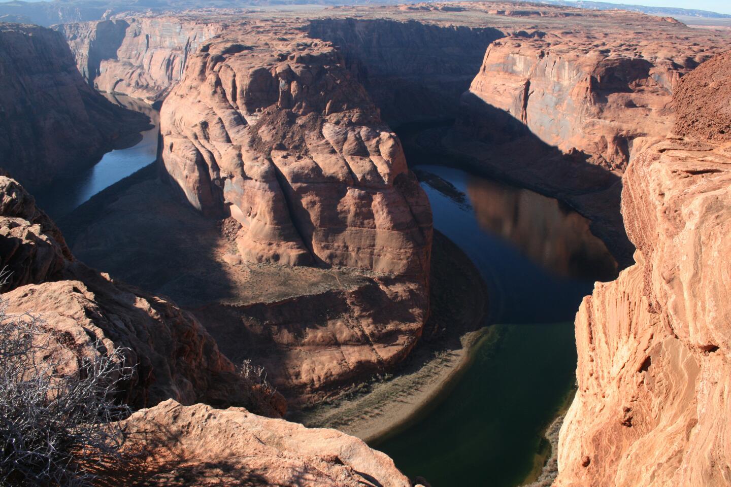
At Horseshoe Bend southwest of Page, the Colorado River curves at just the right spot. Unlike Lower Antelope Canyon, photos, even ones taken by the pros, do not do it justice.
From the easy-to-miss parking lot along Highway 89, an unremarkable 3/4-mile hike takes you to the overlook. There, the earth drops about 1,000 feet to the Colorado River below. The views are stunning. Best of all, it’s free.
How to find Horseshoe Bend: From the intersection of Highway 89 and Route 98, drive about one mile south. On your right, you’ll see a small road that leads to a parking lot.
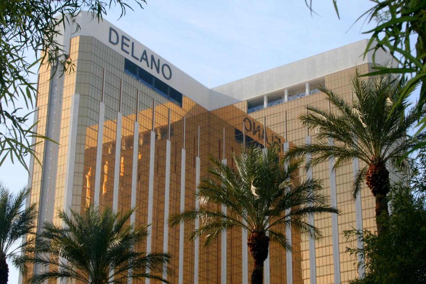
Las Vegas
Vegas doesn’t call to me, but I like stopping on the way to national parks and sights in Utah and Arizona. It takes mundane things, such as Walgreens, buffets, H&M and bathrooms, and makes them interesting by infusing glitz or super-sizing them.
Perhaps it was because she was recovering from the flu, but Cathy, one of my travel buddies, described the Walgreens at the Palazzo as one of the highlights of our Vegas visit. It did have a yogurt bar.
Entertainment
Bellagio Fountains water show — Jets of water dance to music in this brief performance at the Bellagio’s humongous fountain. The free shows start every half-hour during the day and every 15 minutes in the evening. 3600 Las Vegas Blvd. S.
Carnival Midway — At this Circus Circus attraction, you’ll find about 200 games, from Skee-Ball to air hockey. Carnival games are my preferred method for losing money in Vegas. You might get a stuffed animal for your trouble. In between games, watch the free circus acts on the center stage. 2880 Las Vegas Blvd. S.
Bellagio Conservatory and Botanical Gardens — Visit the gardens by March 1 to see the Chinese New Year exhibit. It features mechanical goats. (2015 is the year of the goat.) 3600 Las Vegas Blvd. S.
Sky Lobby at the Mandarin Oriental — Enjoy drinks or the view of the Las Vegas Strip from the hotel’s elegant 23rd floor lobby. 3752 Las Vegas Blvd. S.
Shopping
Las Vegas North Premium Outlets — You’ll find about 150 stories, from American Apparel to Zumiez. 875 S. Grand Central Parkway.
The Forum Shops at Caesars — The mall includes 160 shops, many of them luxury. Most of the stores were too intimidating for me, but I did take a look around what was once the world’s largest H&M. The men’s section could have been bigger. 3500 Las Vegas Blvd. S.
The Shops at Crystals — The CityCenter shopping center has more than 40 high-end stories, including Fendi, Gucci, Hermes, Prada and Versace. 3720 Las Vegas Blvd. S.
Dining
Pho Kim Long — If you’ve had Vietnamese food in Little Saigon or San Gabriel, you’ll be underwhelmed, but the pho and prices are pretty good for Sin City standards. 4029 Spring Mountain Road.
The Buffet at Wynn — I don’t think I ate my money’s worth of food ($34 for weekend brunch), but I did spend three hours trying. The buffet had an entire room devoted to desserts. 3131 Las Vegas Blvd. S.
Veggie Delight — You won’t mind some vegetarian food after a couple trips to the buffet. 3504 Wynn Road.
The Buffet at TI — I left full, but I probably wouldn’t return without the free vouchers. Try some of the mini donuts if you do find yourself here. 3300 Las Vegas Blvd. S.
Lodging
Treasure Island Hotel & Casino — This hotel isn’t glitzy, but if you’re on a budget and want to stay on the Strip, you could do worse. I didn’t like my pillows, but my room was spacious and the two bathrooms were convenient. My 630-square-foot suite was about $125 a night, including the resort fee. The room came with two free buffet vouchers. 3300 Las Vegas Blvd. S.
PLANNING YOUR TRIP
Your itinerary
If you’re leaving from Southern California, here’s a proposed itinerary:
Day 1: Las Vegas — Break up your long drive by stopping in Sin City. A night here is enough for me.
Day 2: Zion National Park — The drive from Las Vegas to Zion takes about 2 1/2 hours. If you’re an avid hiker, you can easily stretch your Zion visit to two or three days.
Day 3: Bryce Canyon — If you don’t like checking in and out of hotels often, make Bryce Canyon a day trip from Zion. You can drive from Zion to Bryce in about two hours. Make sure you leave early and head back before dark, though. The dark roads and frequent deer-crossing signs made me uneasy.
Day 4: Lower Antelope Canyon and Horseshoe Bend — From Zion, a two-hour drive takes you to Lower Antelope Canyon. Horseshoe Bend is nearby, so pair the two. Check out Coyote Buttes if you want to extend your visit.
Day 5: Las Vegas — You’ll probably be tired after a few days of hiking, so break up the drive back as well by stopping in Vegas.
Day 6: Home — Avoid driving back to Southern California on Sunday afternoon. You’ll encounter traffic.
What to take
Clothes: If you go in winter as I did most recently, take plenty of warm clothes, including gloves, long underwear and hats. The temperature dipped into the 20s the day I visited Bryce Canyon.
If you go during warmer months, take water-friendly footwear so you can hike the Narrows in Zion. The popular hike takes you into the river. I recommend Teva sandals.
Food: Unless there’s a snack you know you can’t find anywhere else, save your trunk space for luggage. The Zion area has a few decent markets, and there’s a Walmart near Lower Antelope Canyon. Don’t forget you can pick up anything you need on the way in Las Vegas.
Entertainment: I wish I’d had a good book or a deck of cards with me. Zion and Bryce don’t offer much nightlife.
When to go
If you enjoy the solitude and saving a little money, go in the winter, when rooms can be had for less and the hiking trails are sparsely peopled.
In January, I didn’t have to dodge the cameras of other tourists at Lower Antelope Canyon. The solitude comes with a price, though. During the winter, Springdale, Utah, the town at the western entrance of Zion, is quiet. Most of the restaurants and shops are closed. If you don’t like driving, the park shuttle only runs from April to the end of October.
On the other hand, roads that are normally reserved for park shuttles open to private vehicles in the off-season. If there’s too much snow, parts of Bryce Canyon may close.
If you’re hoping to stay inside the park, Bryce Canyon Lodge usually opens in March and closes in November.


Sign up for The Wild
We’ll help you find the best places to hike, bike and run, as well as the perfect silent spots for meditation and yoga.
You may occasionally receive promotional content from the Los Angeles Times.


