El Niño hits California: These maps tell the story of heavy rains
California is about to be hit by the first El Niño storm of the year. It's the beginning of what could be a week of rain in the drought-battered state.
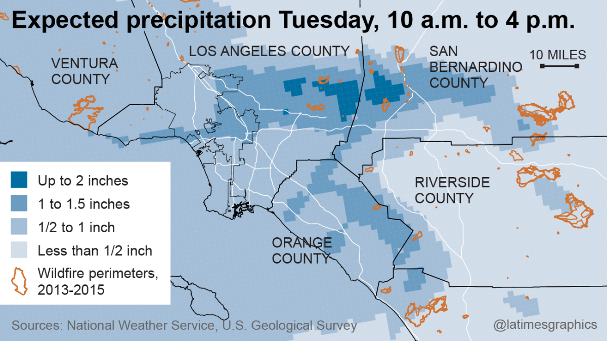
In Southern California, the heaviest storm is expected Tuesday, when up to two inches of rain is forecast to drop on the coast and valleys and up to four inches could pour onto the mountains and foothills. Forecasters expect four storms to hit the Southland by Friday, but caution that rain is only a part of the story. Waves up to 10 feet could slam the coast south of Point Concepcion through Tuesday and grow to as big as 15 feet on Thursday.
See the most-read stories this hour >>
Parts of Northern California will see more rain and snow. Here are some National Weather Service maps that help explain the weather picture.
A series of storms from the Pacific
Here is a look at the storms set to hit California this week:
A wet period
Rainfall totals will be higher than normal:
Rain projections
Here is a look at projected rainfall totals for Southern California:

Sierra snow
Here is a look at what the storms will bring to the Sierra Nevadas, a key source of California water:
Water and Power is The Times' guide to the drought. Sign up to get the free newsletter >>
ALSO
Video: How to drive in the rain
Start your day right
Sign up for Essential California for news, features and recommendations from the L.A. Times and beyond in your inbox six days a week.
You may occasionally receive promotional content from the Los Angeles Times.


